File:Mexican Cession.png

Size of this preview: 800 × 530 pixels. Other resolutions: 320 × 212 pixels | 2,328 × 1,541 pixels.
Original file (2,328 × 1,541 pixels, file size: 2.81 MB, MIME type: image/png)
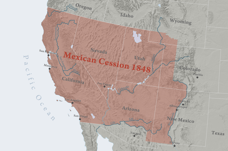
Map of the Mexican Cession. The territories ceded by Mexico to the U.S. in 1848 in the Treaty of Guadalupe Hidalgo, which ended the Mexican-American War (1846 – 1848). The land lost equalled one third of Mexico's total territory — and became California the Southwestern United States.. Kballen - Own work Permission details You may select the license of your choice.View more CC BY 3.0view terms File:Mexican Cession.png Created: 5 April 2008
File history
Click on a date/time to view the file as it appeared at that time.
| Date/Time | Thumbnail | Dimensions | User | Comment | |
|---|---|---|---|---|---|
| current | 00:19, 25 June 2019 | | 2,328 × 1,541 (2.81 MB) | Admin (talk | contribs) | Map of the Mexican Cession. The territories ceded by Mexico to the U.S. in 1848 in the Treaty of Guadalupe Hidalgo, which ended the Mexican-American War (1846 – 1848). The land lost equalled one third of Mexico's total territory — and became Califo... |
- You cannot overwrite this file.
File usage
The following page links to this file: